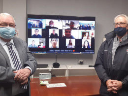
With the assistance of NSW Spatial Services, Bathurst Regional Council has taken a significant step forward in its technological capabilities by engaging aerial 3D specialists to capture new data that will extend the Bathurst Spatial Digital Twin. This cutting-edge project, a collaboration between NSW Spatial Services and Bathurst Regional Council, marks a milestone as the first of its kind for a regional council in New South Wales.
The centrepiece of the initiative is a highly detailed 3D digital representation of approximately 400 hectares of the Bathurst Central Business District (CBD). Captured at an impressive resolution of 2 centimetres, this level of detail provides a remarkably accurate digital model of the buildings, streetscapes, and infrastructure within the Bathurst CBD. The result is a comprehensive visualisation tool being used to support a wide range of council operations and community services.
Within the Bathurst Digital Twin, users can access and identify key community assets such as bus stops, disabled parking spaces, electric vehicle (EV) charging stations, and off-leash dog exercise areas. This accessibility provides residents, businesses, and visitors with valuable information, enhancing convenience and urban mobility while promoting smarter resource management across the city.
Beyond public information, the Bathurst Digital Twin is also proving to be an invaluable tool for urban planning and development. The advanced 3D model allows Council to integrate proposed development projects into the digital environment, enabling planners and the community to visualise how future structures will interact with the existing landscape. This capability supports a more transparent and informed planning and approval process, reducing ambiguity and improving stakeholder engagement in local development projects.
Looking ahead, Council has announced plans to expand the Bathurst Spatial Digital Twin to cover the South Bathurst area. This expansion, scheduled for early 2025, will involve a high-resolution aerial survey conducted by specialised teams. The flyover, expected to take between 1.5 and 2 hours, will capture updated imagery, contingent on favourable weather conditions during January and February of that year. Once the data is processed, the expanded digital twin for South Bathurst is anticipated to be available later in 2025.
Council remains committed to broadening the coverage of the digital twin to other parts of the city as funding permits. This phased approach ensures that the benefits of the technology can be extended to a wider area over time, supporting smarter city management, more effective community services, and forward-looking urban development strategies.
The Bathurst Spatial Digital Twin is setting a benchmark for regional councils across the state, showcasing how modern technology can be harnessed to create smarter, more connected communities while preserving the city’s unique character and planning for its sustainable growth.


