


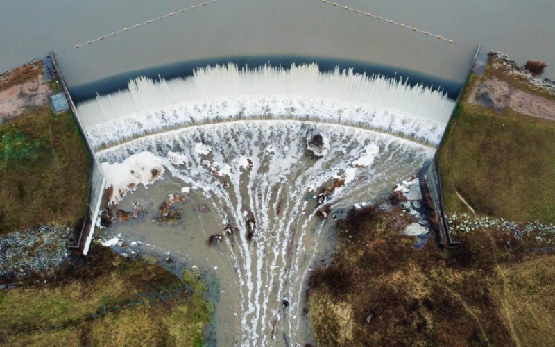
Unseasonal rains impacted the region over the last week with some areas receiving their full monthly rainfall in just 24 hours.
Areas across the Central West were impacted by flooding, road closures and power failures as the rains continued to fall.

The Bureau of Meteorology have recorded 172.4mm rain in Lithgow for the first 6 days of July, significantly more than the average for this time of the year at 60.8mm. The wettest July on record was in 1904 for Lithgow with 319mm recorded, the rest of the months forecast rain will determine if that record is eclipsed, not something the local community would be hoping for given the impacts the rain has already had in the region.
As flood waters are starting to recede and some roads reopen for now, there is significant damage to some regional roads and also to the rail infrastructure. This will take tome to assess and determine a rectification plan.
Whilst Bathurst didn’t record as much rain with only 25.6mm recorded, the down stream affects of the water catchment meant that the Hereford Street bridge was once again inundated, and many other regional roads were affected as well.
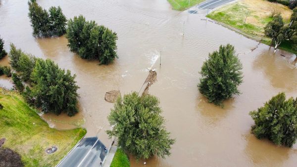
The most important thing in severe weather events is always to stay safe, particularly on roads and severe drive through flood waters.